
I recently found out about a bunch of cool backcountry overlanding routes maintained by the folks at Oregon Off-Highway Vehicle Association (OOHVA) called the Oregon Back Country Discovery Route (OBCDR). These routes are hand-picked to provide hundreds of miles of off-road enjoyment through Oregon’s vast outdoor playground. These roads are open to the public, but cultivating and organizing the maps isn’t free. Before I ordered them I did some digging to try to find out what I was going to get for my money — I was hoping that it wouldn’t just be a single large map lacking in enough detail to really see the route. Now that I’ve received my packet, I thought I’d provide some information for other people that might be on the fence of whether or not the full set of information is worth $155. Spoiler: it is.
On the website, this is about as much detail as you’re able to see:

Clearly just an overview, you can see that the trail system is very large, but you can’t really see any detail other than the general direction and length of each section. To be honest, this is what had me most concerned before I ordered it — I was hoping I wasn’t just going to get a very large version of the above image.
Almost immediately after I ordered the full set of maps, I got an email with a tracking number and then this showed up today:
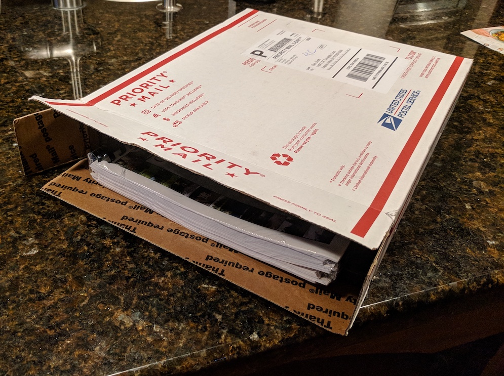 What’s that? Yep, it’s a shrink-wrapped set of spiral-bound maps. I was impressed.
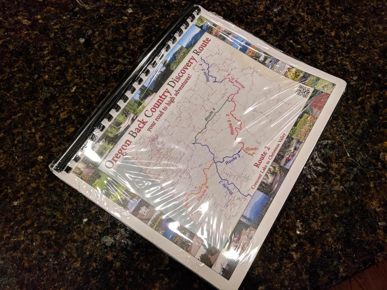
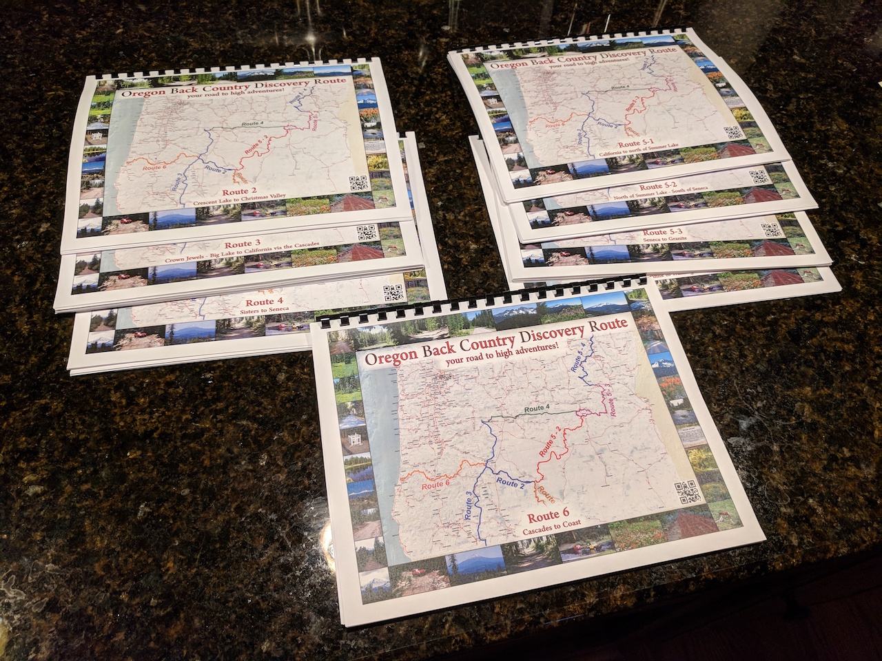
Once I opened the package, I found each route in its own spiral-bound set printed on pretty decent paper with what looks like a good laser printer. These aren’t thick, glossy pages like you’d find in a book, but they also shouldn’t smudge if they get a little wet, nor tear too easily.
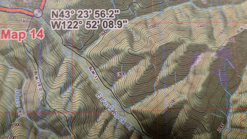
As you peer inside one of the bound manuals, you see that it’s arranged much like one of those large road atlases, where each section of the route is covered by a specific page. At the beginning they lay out all the pages into an index, so you can see the ordering of the pages, as well as which connects to which and by what edge:
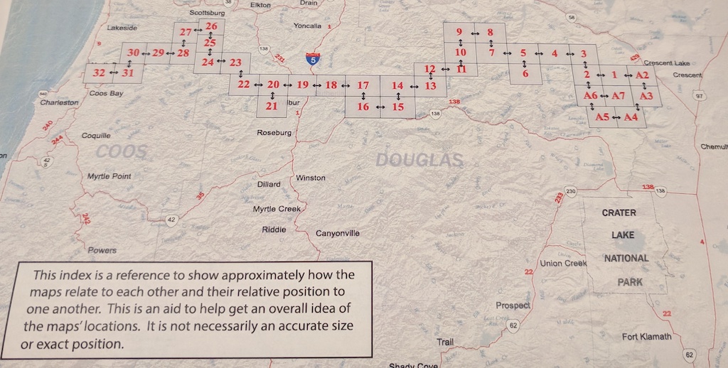
It’s things like this that really make it clear that some time and thought has gone into this, and that you’re getting more than just a map from the forest service that is marked up by hand at high scale.
The actual map pages themselves are very easy to read, with excellent contrast and large labels. Some points along the way are marked clearly with latitude and longitude (and the datum!) so you can synchronize your GPS with the map if things get wonky out in the field. Map edges are also labeled with what map they connect to so that it’s easy to know which one to go to next when there are multiple paths off the current page.
The website promises that GPS tracks are available upon request. After receiving my packet in the mail, I sent an email to the maintainer asking about these files and received them within the hour. The tracks are separated one per file, and provide not only paths but also many waypoints along the routes. These loaded right up into Garmin Basecamp and will surely make it easy to follow. When I drive these, I’ll probably try to do most of the navigating electronically, keeping the paper maps safe for emergencies.
Possibly the only thing missing from the information provided is a little bit of a tactical overview on each route with logistics (e.g “be sure to fill up on gas before you leave this area” or “there won’t be a flat spot to camp for 20 miles”![]() . Although the research, planning, and figuring-it-out-on-the-fly of those logistics is part of the fun. There are also a number of waypoints marked for things like formal campgrounds, and I even saw a service station indicated when crossing through a town.
. Although the research, planning, and figuring-it-out-on-the-fly of those logistics is part of the fun. There are also a number of waypoints marked for things like formal campgrounds, and I even saw a service station indicated when crossing through a town.
So, overall, I’m quite impressed with what I have seen so far. Obviously I haven’t tried following any of these routes yet, but we’ll definitely be out there on some of them this summer. Hopefully the above overview gives you enough of an idea about what you get from OOHVA and you decide to purchase them yourself. At the time of this writing the full set of all the routes was $155, but individual routes are available for as little as $15.
Thanks for the review of the Maps…. I have been on the fence on ordering them as well. I plan on doing the Route 4 this August ( I live in Bend ). I had found a lot of other people’s GPS tracks via Gia GPS, but old-fashioned maps are always nice to have. Would be great to see a review after you did the route to see how well they pan out.
73
KI7UNJ
Casey Tucker
For what it’s worth, I’ve done several of these now and I do find that the paper maps offer detail that the GPX files don’t. The files they provide are “routes” not “tracks”, which means you really need a GPS or mapping software that can snap those to the actual roads. Otherwise they’re pretty hard to follow and require a little more driving around at complex intersections to make sure you can get on the road necessary to hit the next route peg. Also, several of the routes have multiple options at several places, like a “long way” and “short way” around a feature, or one path that is only for street-legal vehicles, etc.
The paper maps provide the contour of the road along the expected route, and make it a lot clearer when the route splits into two options. You could definitely get along with just the files, but the paper maps are a nice supplement.